58 Landslide Types
Although many types of mass movements are included in the general term “landslide,” the more restrictive use of the term refers only to mass movements, where there is a distinct zone of weakness that separates the slide material from more stable underlying material. The two major types of slides are rotational slides and translational slides.
Rotational slide: This is a slide in which the surface of rupture is curved concavely upward and the slide movement is roughly rotational about an axis that is parallel to the ground surface and transverse across the slide (Figure 2a).
Translational slide: In this type of slide, the landslide mass moves along a roughly planar surface with little rotation or backward tilting (figure 2b). A block slide is a translational slide in which the moving mass consists of a single unit or a few closely related units that move downslope as a relatively coherent mass (figure 2c).
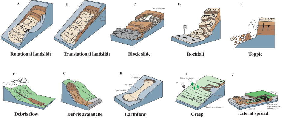
Diagram below shows general landslide elements in rotational/slump type:


Slump example: Landslide Occurs in Alta, Norway – Jun. 3, 2020
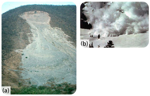
Rock falls are abrupt movements of masses of geologic materials, such as rocks and boulders, that become detached from steep slopes or cliffs.
When large amounts of rock suddenly break loose from a cliff or mountainside, they move quickly and with tremendous force. These are rockfalls and topples.
Separation occurs along discontinuities such as fractures, joints, and bedding planes, and movement occurs by free-fall, bouncing, and rolling.
Falls are strongly influenced by gravity, mechanical weathering, and the presence of interstitial (i.e. in porous space) water.
https://www.youtube.com/watch?v=JbxItsOXeNk&t=174s
Some mudflows and avalanches can move as fast as 200 to 300 km/hour.
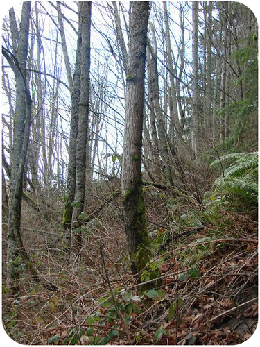
Slowest landslide is creep. Creep is the imperceptibly slow, steady, downward movement of slope-forming soil or rock. Movement is caused by shear stress sufficient to produce permanent deformation, but too small to produce shear failure. There are generally three types of creep:
- Seasonal, where movement is within the depth of soil affected by seasonal changes in soil moisture and soil temperature
- Continuous, where shear stress continuously exceeds the strength of the material
- Progressive, where slopes are reaching the point of failure as other types of mass movements. Creep is indicated by curved tree trunks, bent fences or retaining walls, tilted poles or fences, and small soil ripples or ridges
Curves in tree trunks indicate creep because the base of the tree is moving downslope while the top is trying to grow straight up (figure 2). Tilted telephone or power company poles are also signs of creep.
Creep was first noted in cemeteries, see below:

However, many geographic areas experience creep because of human activity and unfavorable geologic activities. Below is a photo of small street in the village Antigua Santa Catarina Ixtahuacán (Guatemala). It shows slight deformations in the pavement caused by the creep.
 Below is a photo of the whole village with small houses and attached agricultural plots:
 This is an exampe of the soil that is very susceptible to creep: with excess of water this soil slowly reduces its volume, causing slope deformations

A slow-motion landslide in Jackson, Wyoming, has split a home in half and forced dozens to evacuate. The landslide continues to creep toward the resort town that has now become a tourist attraction. Vinita Nair reports.
Landslides are exceptionally destructive. Homes may be destroyed as hillsides collapse. Landslides can even bury entire villages. Landslides may create lakes when the rocky material dams a stream. If a landslide flows into a lake or bay, they can trigger a tsunami (figure 4).
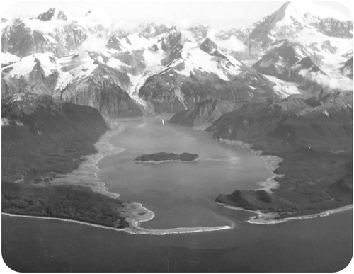
See the video below about Lituya Bay event: landslide on the flank of the mountain caused destructive tsunami:
Lahars, Mudflows and Debris Flows
Added water creates natural hazards produced by gravity.
On hillsides with soils rich in clay, little rain, and not much vegetation to hold the soil in place, a time of high precipitation will create a mudflow. Mudflows follow river channels, washing out bridges, trees, and homes that are in their path.
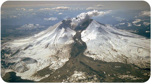
A lahar is mudflow that flows down a composite volcano (figure 2). Ash mixes with snow and ice melted by the eruption to produce hot, fast-moving flows.
Debris Flow: “mudflow on steroids”
