93 What am I doing in Climate Science?
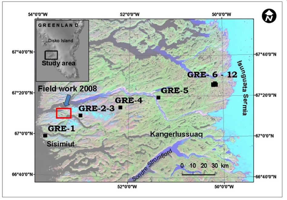
Greenland Field Campaign, 2005 – 2010
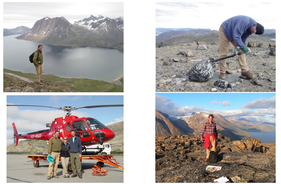
Field work 2005 – 2008: How fast was ice retreat from the eastern Greenland margin?
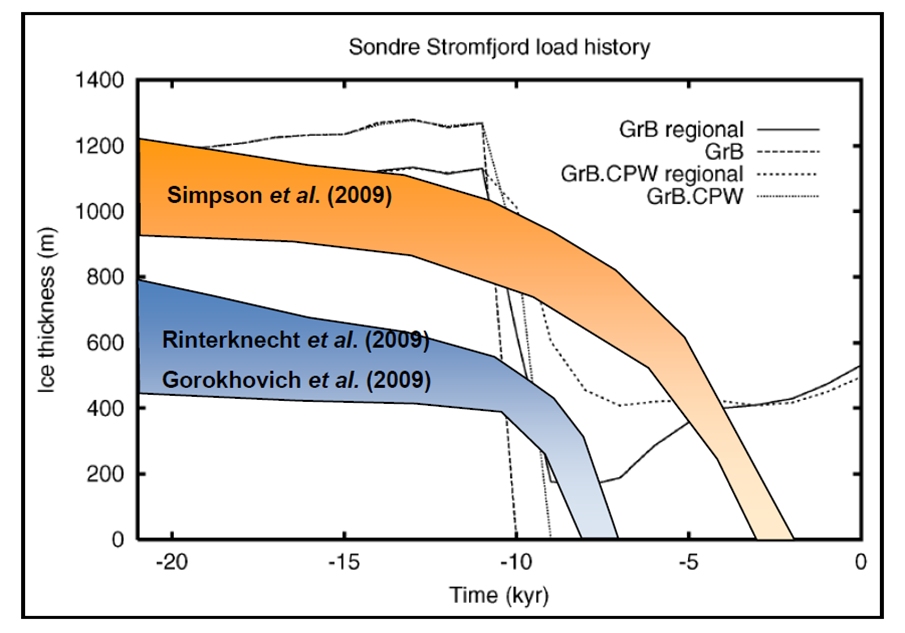
Results: we discovered new data and established first 10Be isotope dates in eastern Greenland; our data showed that ice margin was not as thick as climate models predict (see below). Does it mean that existing models should be re-assessed?
Sources:
Rinterknecht V., Y. Gorokhovich. 2010. Development of empirical data sets to further constrain glacial modeling in southwestern Greenland. Geophysical Research Abstracts, Vol. 12, EGU2010-PREVIEW, 2010, EGU General Assembly 2010
Gorokhovich Y., V. Rinterknecht. 2009. Deglaciation of the western coastal margin of Greenland: an insight through the latest integrated studies”, AGU, December, 2009
Rinterknecht V.R., Y. Gorokhovich, J. Schaefer, M. Caffee. 2009. Preliminary 10Be Chronology for the Last Deglaciation of the Western Margin of the Greenland Ice Sheet. Journal of Quaternary Science, 24 (3) pp. 270-278
From Greenland to Hudson Valley: solving the mystery of the glacial retreat timing on Hudson
Isotope Dating Results :
Carbon 14 : 12,000 – 13,000 years
10Be : 19,000 – 20,000 years
Question: which method is correct?
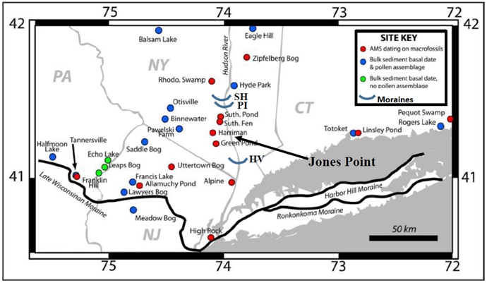
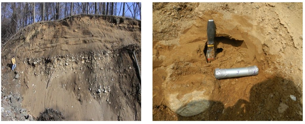
Jones Point field study area (2003, 2014): lateral glacial moraine
Goal: establish the date of glacial deposits at Jones Point (Bear Mountain, NY) using optically stimulated luminescence (OSL) method, different from Carbon 14 and 10Be.
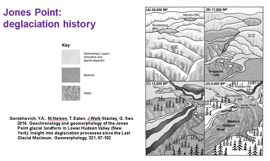
Source: http://sees.qc.cuny.edu/files/2018/11/GorokEaton18Geomorphology.pdf
American Geophysical Union Annual Meeting 2021
Abstract
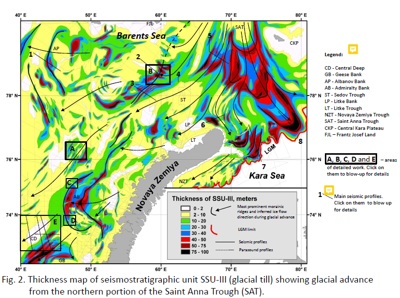
Our knowledge of glacial history of the western (Norwegian) part of the Barents Sea has greatly improved during the last decades, notably due to the high-resolution multibeam swath bathymetry data. In contrast, published seafloor data from the eastern part of the Barents Sea and the Kara Sea are much more sparse. This study presents new geophysical/geological evidence for reconstructing glacial dynamics of the eastern part of the Barents-Kara Ice Sheet during the Last Glacial Maximum and subsequent deglaciation.
Archival data used in this study include more than 300,000 km of sparker and high-resolution Parasound profiles verified by boreholes drilled with continuous core recovery to 50-100 m below sea bed. This dataset was used to construct continuous geological cross-sections and a series of maps, including detailed bathymetry (in 10-m isobaths) and sediment thickness maps of major seismo-stratigraphic units (SSU). Based on the bathymetric and sediment thickness data we mapped megascale glacial lineations, drumlin-like ridges up to 50 m high and subglacial channels up to 100 m deep, as well as accumulations of glacial deposits (basal, lateral and end moraines) and ice-proximal acoustically transparent bodies (ATBs).
Spatial and stratigraphic analysis of these bedforms enables us to put forward a new hypothesis that ice moved on the shelf from the Arctic Ocean along the Saint Anna Trough (SAT). Further south, near the northern tip of the Novaya Zemlya islands, the ice flow split into three major lobes moving to the southwest into the Barents Sea and to the south and southeast into the Kara Sea. Deglaciation in the study area progressed with several ice stillstands and subsequent readvances marked by end-moraines and accumulation of ice-proximal sediments. During deglaciation events, when the SAT became ice free due to iceberg calving, the ice flow reversed its direction toward the SAT, forming a fluting and a massive ATB on the western SAT slope. The exact timing and mechanisms of the ice transgression(s) from the Arctic Ocean are not well understood. Additional high-resolution data such as multibeam bathymetry surveys are needed to verify the spatiotemporal distribution of glaciogenic bedforms, and glaciological modeling is required to comprehend the ice dynamics and put it in the pan-Arctic context.